chargement...


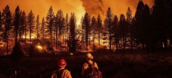
To help prevent forest fires, the Moroccan National Forestry Agency (ANEF) issues daily risk maps based on scientific prediction models. For July 29-31, 2024, analyses considering forest types, combustibility, flammability, and topo-climatic factors have identified several high-risk areas.
Chefchaouen, Taza, Taroudant, Oujda-Angad, Azilal, Béni Mellal, Ifrane, Khénifra, Sefrou, and Guercif face extreme risk (red level). Tangier-Assilah, Al Hoceïma, Ouezzane, Driouch, Taounate, and Essaouira are at high risk (orange level). Fahs-Anjra, Larache, Tétouan, M'Diq-Fnideq, Rabat, Salé, Skhirate-Témara, Kénitra, Berkane, and Nador are at medium risk (yellow level).

Authorities urge increased vigilance from forest residents, visitors, and workers. Preventing fires is crucial. Report smoke or suspicious activity to local authorities immediately.


 Fil Info