chargement...


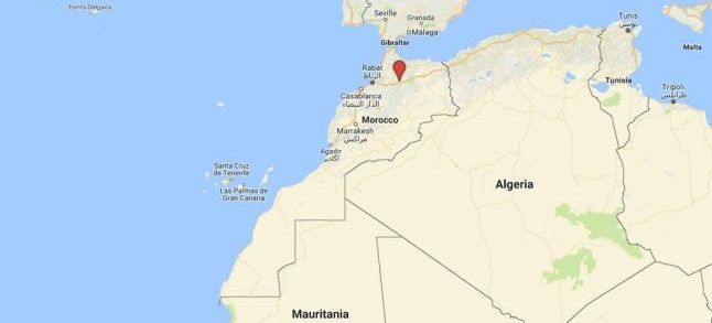
Google Maps is making headlines today as several Moroccan and Polisario Front newspapers reported that the web mapping service deleted the geographical line separating the Northern and Southern provinces of the Kingdom.
The information was first published by Moroccan online newspaper Alyaoum24 on Friday. The Arabic-language media reports that the American multinational technology company has responded to a petition submitted by a number of Moroccans, who urged Google in August 2015 to delete the infamous line.
Alyaoum 24 indicates that, indeed, Google removed Western Sahara from its maps on Friday, 20th of July. Four days later, French-language online newspaper Le 360 wrote about the same measure. The media has even qualified Google Maps’ move as bad news for the Front, which is «struggling these days to cope with its defeats».
Le SiteInfo has also published an article on the topic, stressing that Google Maps’ decision sparked tension in the Front.
Tension in the Front
On the same day, Sahrawi platform, Futuro Sahara, joined the club, arguing that it was an «unfair measure». The Polisario newspaper put the blame on Morocco, asking Sahrawis to fight back.
It has even published a screenshot of a message it is intending to send to Google, urging it to correct the «mistake» it made.
On the other hand, Moroccan newspaper Kifach told social media users that they were able to successfully defend the sovereignty of their country and pressure big companies such as Google.
Old news is no news
It seems, however, that some of these newspapers have the memory of a goldfish. In fact, in 2015 Google updated its Morocco map by removing the line separating the Kingdom from its southern provinces.
More than that, Le 360, Futuro Sahara and Alyaoum24 did not explain in their articles that Google’s measure has nothing to do with Morocco. In an article published in 2015 by French magazine L’OBS, it is pointed out that the American company updated its maps in order not to «offend anyone».
 A screenshot taken on the 25th of July, 2018, showing how the Moroccan man looks from outside the country./Ph. DR
A year earlier sources reported that several users had paid attention to the updated borders. Here we cite the example of Crimea, as seen from Russia and Ukraine. The same thing applies to other disputed provinces in the world.
To put it in other words, Google had simply decided to adapt its maps to the local context in the country while keeping the UN maps elsewhere. This is the case for the kingdom. Accessing Google Maps with a Moroccan IP address wouldn’t show the line in question while in other parts of the words it can be clearly seen.


 Fil Info